 Alta Via dei Lattari1876 — 20262026 Edition
Sunday 11 October 2026
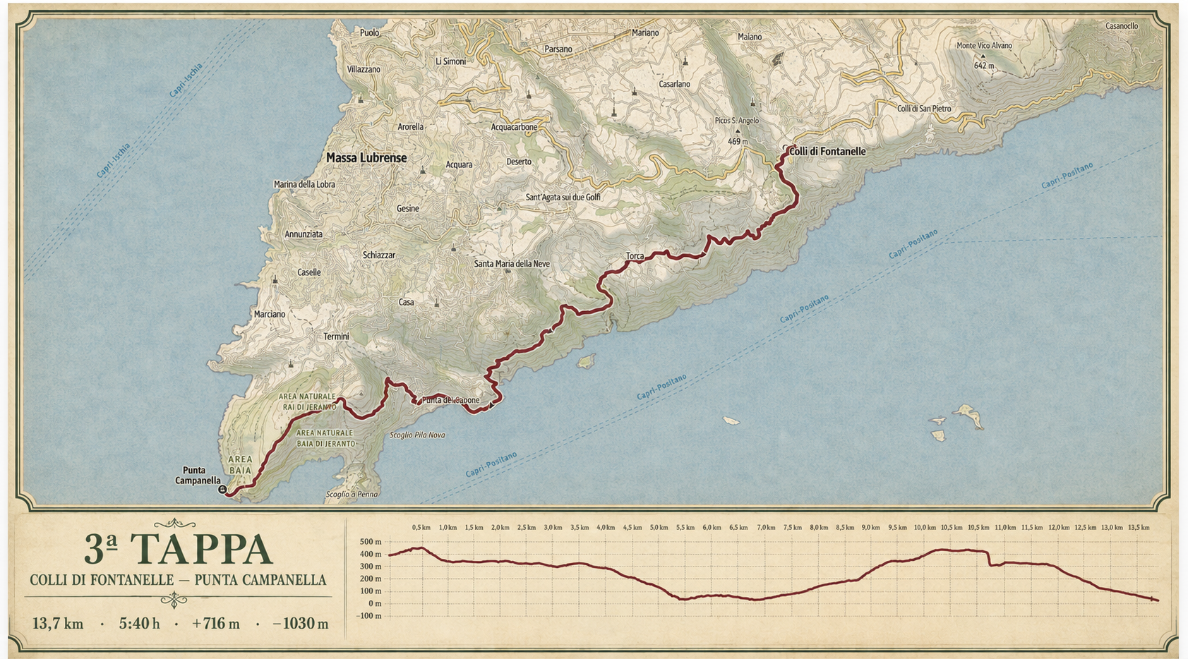
Colli di Fontanelle — Punta Campanella
The final stretch of the ridge follows the Sentiero delle Sirene to the headland facing Capri.
Places along the way
A stage to be read.

The final stage gradually leads towards the Mediterranean. Reaching Punta Campanella is the closing ritual of the Alta Via.
Colli di Fontanelle · Sant’Agata sui Due Golfi · Monte San Costanzo · Punta Campanella
Technical data and operational points will be checked in the field and shared in the Participant Guide.
Open on Outdooractive ↗