 Alta Via dei Lattari1876 — 20262026 Edition
Saturday 10 October 2026
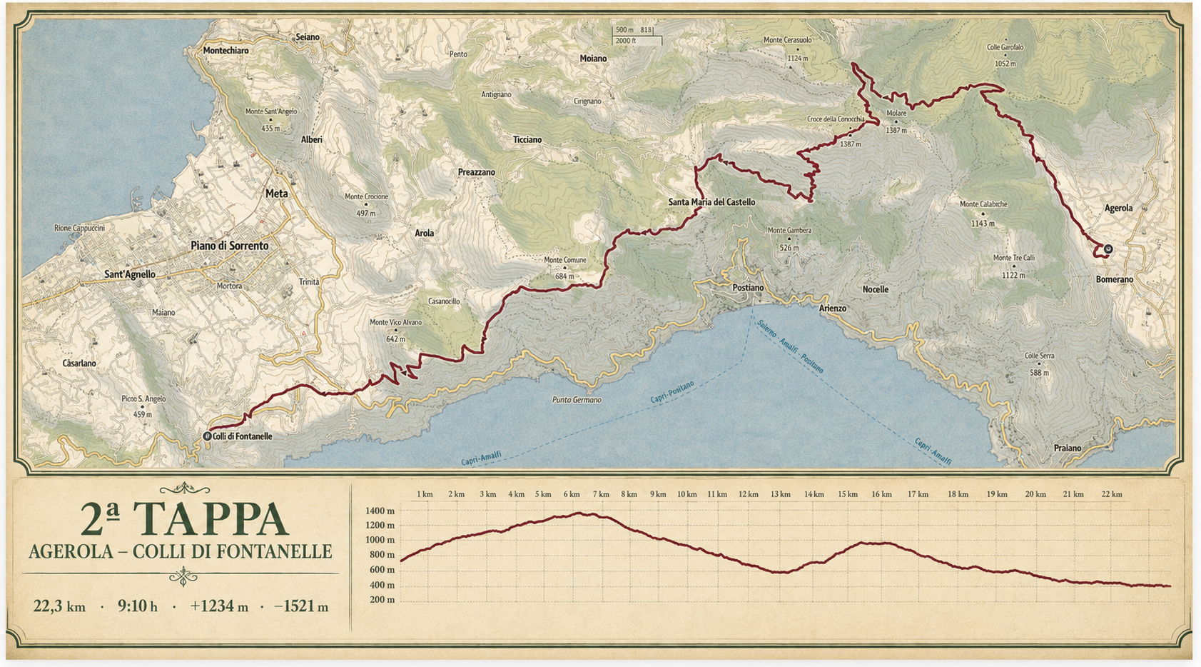
Agerola — Colli di Fontanelle
The high-altitude day, across Conocchia and Monte Comune, with wide-open views over both gulfs.
Places along the way
A stage to be read.

This is the central and most mountainous stage. The elevation, distance and continuity demand a steady pace and solid preparation.
Agerola · Faito · Croce della Conocchia · Monte Comune · Colli di Fontanelle
Technical data and operational points will be checked in the field and shared in the Participant Guide.
Open on Outdooractive ↗