 Alta Via dei Lattari1876 — 20262026 Edition
Friday 9 October 2026
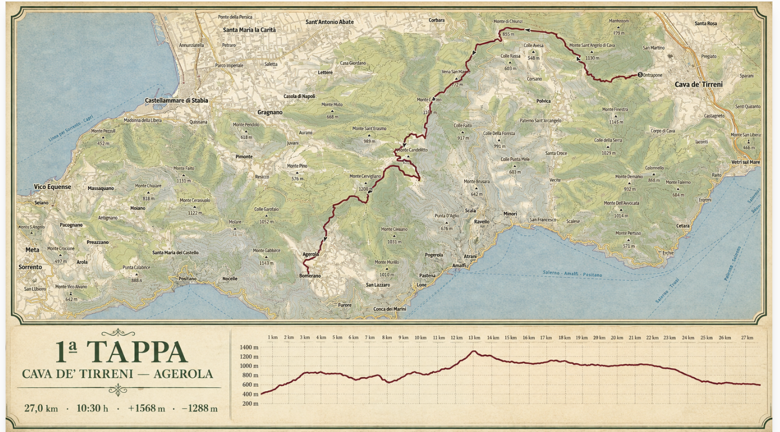
Cava de’ Tirreni — Agerola
From the Metelliana Valley into the heart of the Lattari Mountains, along ancient routes, across passes and over the Monte Cerreto ridge.
Places along the way
A stage to be read.

The first day establishes the character of the crossing: long, varied and with substantial elevation gain. The route connects the Cava side of the mountains with the Agerola plateau.
Cava de’ Tirreni · Contrapone · Chiunzi Pass · Monte Cerreto · Agerola
Technical data and operational points will be checked in the field and shared in the Participant Guide.
Open on Outdooractive ↗